
Blackfoot Communications is modernizing its network management with FNT Command and FNT GeoMaps. By centralizing and geographically visualizing fiber and fixed wireless infrastructure, the telecommunications provider is creating a reliable data foundation for more efficient network operations, route analysis, and future automation.
The Challenge: Moving Beyond Manual Network Research
Blackfoot Communications needed to modernize its network inventory as its infrastructure, technologies, and services continued to evolve. A legacy network inventory, fragmented network data, manual route research, and limited network visibility made it increasingly difficult to access reliable network information quickly and efficiently.
The Solution: From Fragmented Network Data to a Connected View
After evaluating more than a dozen network inventory platforms, Blackfoot Communications selected FNT Command and FNT GeoMaps to modernize how network infrastructure is documented, visualized, and used across the organization.
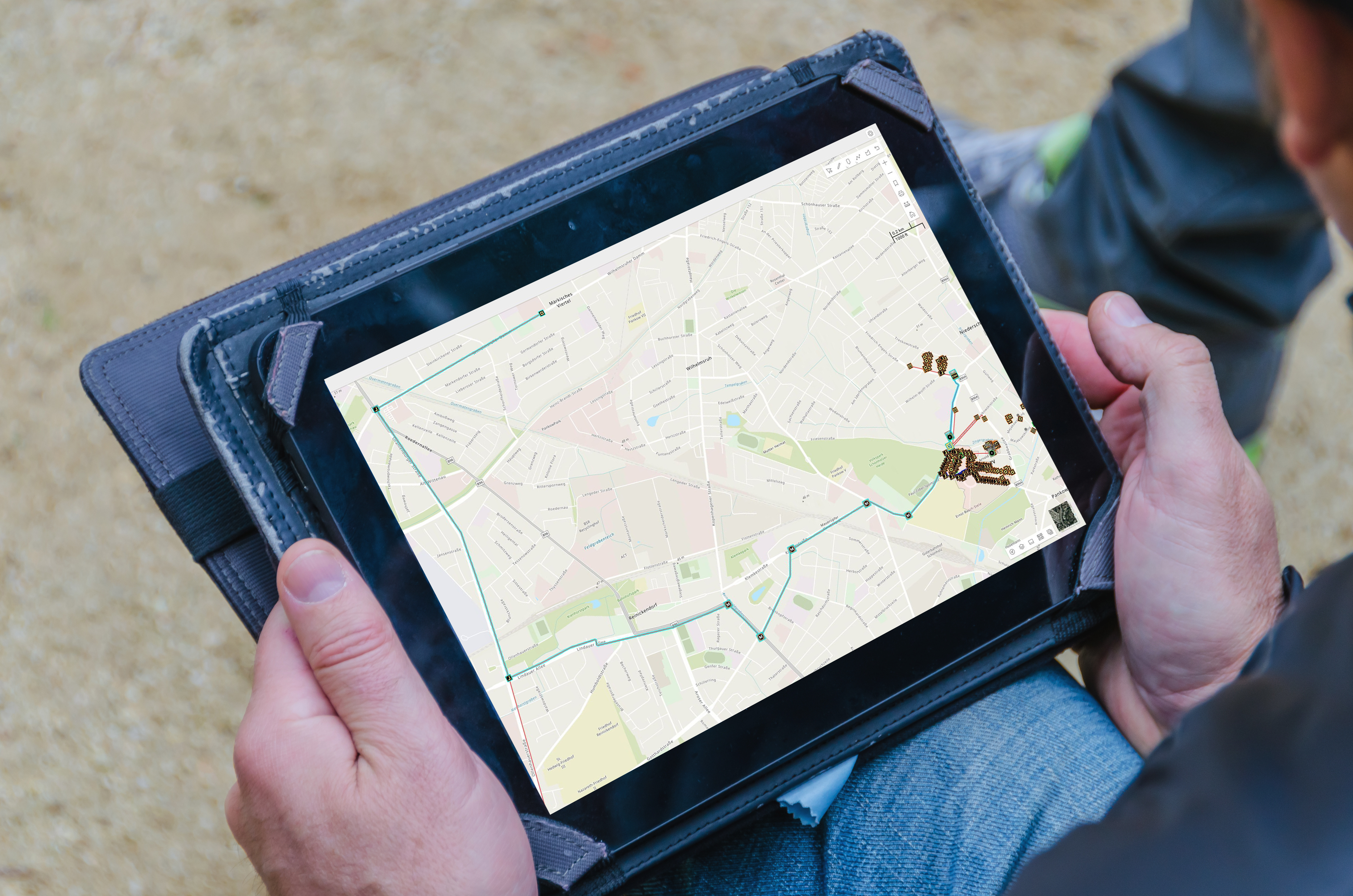
FNT Command provides Blackfoot with a modern platform for documenting and managing network resources. It replaces the limitations of the long-established inventory environment with a scalable foundation that can evolve alongside the company’s fiber, fixed wireless, and transport networks.
FNT brings inside plant and outside plant data together in one connected model, helping Blackfoot replace fragmented information with a more consistent and reliable source of network data. This structured foundation also supports future integrations and automation.
With FNT GeoMaps, teams can visualize fiber infrastructure and network routes geographically instead of tracing connections manually across separate records and maps. This makes route, serviceability, and redundancy analysis easier and more efficient.
FNT provides engineering, sales, technical assistance, and network operations teams with access to a shared view of the network. By combining network inventory data with geographical context, Blackfoot can better understand infrastructure, routes, construction progress, and connectivity across the organization.
How Blackfoot Improves Network Operations with FNT
- Visualize network routes: FNT GeoMaps provides a geographic view of fiber routes and infrastructure, making connections easier to understand and communicate.
- Analyze route diversity: Teams can compare fiber paths and identify shared segments that could create a single point of failure.
- Support fault localization: Accurate route data combined with OTDR measurements helps narrow down the location of fiber cuts and supports more targeted field operations.
- Standardize fiber and fixed wireless: A consistent information structure gives technical teams a unified way to access and interpret service data across different access technologies.
A Phased Journey to a Connected Network Data Foundation
Customer Perspective
“The biggest difference was that FNT brought together the capabilities we needed in one platform. The direct integration of OSP data and ISP data was critical for us because we needed a single, connected view of the network.”
Ty Belnap
Network Engineering Manager
Blackfoot Communications
Blackfoot Communications with FNT: Key Facts
Ready to Gain a Clearer View of Your Network?
Bring network infrastructure, connectivity, and geographical data together in one connected environment. With FNT Command and FNT GeoMaps, telecommunications providers can improve network visibility, streamline infrastructure management, and build a reliable foundation for more efficient operations, integration, and automation.


